Our start wasn't optimal. We arrived at the Annette Lake trailhead shortly after noon on Saturday due to a late morning link-up and stops at what seemed like every town between Monroe and North Bend. But we had a few days now with nothing to do besides hike, relax, eat, and take a dip or two, so we weren't too worried. What's the rush? Stop for gas. Stop for lunch. Get a coffee. We'll get there, eventually. Meanwhile, we'll enjoy the journey.
Traffic on popular hiking trails in the Pacific Northwest, especially mid-Saturday, sometimes replicates rush hour on the roads back in the cities. This hike appeared to be popular. Cars lined the sides of the gravel road approaching the parking lot, and we hoped we weren't still a mile out from the lot. Turns out it was around the corner and we found a spot just fine. When we stepped out of the car we were reminded that we'd be also doing this hike during the hottest part of the day. Ah... late starts. We rucked up and headed out in the thick of foot traffic.
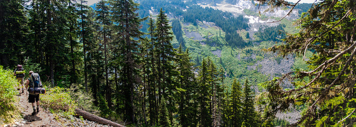
The trail starts off along the babbling waterfalls of Humpback Creek, meandering through a small stretch of woods, past some powerlines, and then across Iron Horse Trail before things settle down a bit. Through occasional openings along the mostly sidehilling hike we could see the long ridge of Humpback Mountain paralleling our path and the valley where Humpback Creek runs. A run of switchbacks brings you to the home stretch where, as the vegetation slowly takes on the lakeside appearance, you might find yourself thinking "this must be it" a number of times. Eventually, if you just keep walking, you will reach "it."
Traffic on popular hiking trails in the Pacific Northwest, especially mid-Saturday, sometimes replicates rush hour on the roads back in the cities. This hike appeared to be popular. Cars lined the sides of the gravel road approaching the parking lot, and we hoped we weren't still a mile out from the lot. Turns out it was around the corner and we found a spot just fine. When we stepped out of the car we were reminded that we'd be also doing this hike during the hottest part of the day. Ah... late starts. We rucked up and headed out in the thick of foot traffic.
The trail starts off along the babbling waterfalls of Humpback Creek, meandering through a small stretch of woods, past some powerlines, and then across Iron Horse Trail before things settle down a bit. Through occasional openings along the mostly sidehilling hike we could see the long ridge of Humpback Mountain paralleling our path and the valley where Humpback Creek runs. A run of switchbacks brings you to the home stretch where, as the vegetation slowly takes on the lakeside appearance, you might find yourself thinking "this must be it" a number of times. Eventually, if you just keep walking, you will reach "it."
Our worries about too much traffic and a crowded campsite were for naught. Despite the trail being busy, hikers were spread out so much that there was still plenty of peace and quiet along the way. Anyway, one shouldn't expect solitude on a hike this close to town in this fine of weather.
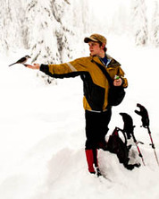
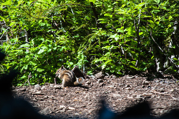
We found a nice campsite in a stand of trees on the east shore of the lake. Right on the water, with a beautiful view of Abiel Peak to the south, from which snow was melting and pouring down a couple waterfalls into the lake, and Humpback Mountain across from us to the west. Fellow hikers provided most of the action around camp during the days. A couple little critters did show their faces, though. One particular chipmunk, in its quest for food, ran right across the foot of one of our group and put a little fright into him.
We found a nice campsite in a stand of trees on the east shore of the lake. Right on the water, with a beautiful view of Abiel Peak to the south, from which snow was melting and pouring down a couple waterfalls into the lake, and Humpback Mountain across from us to the west. Fellow hikers provided most of the action around camp during the days. A couple little critters did show their faces, though. One particular chipmunk, in its quest for food, ran right across the foot of one of our group and put a little fright into him.
 |  |
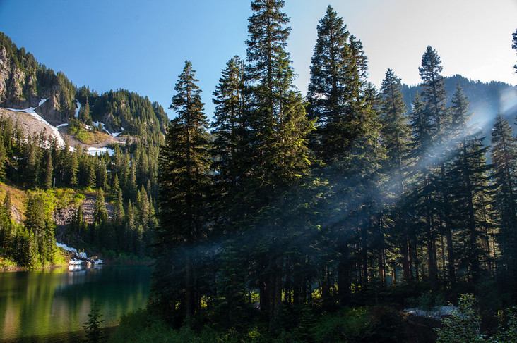
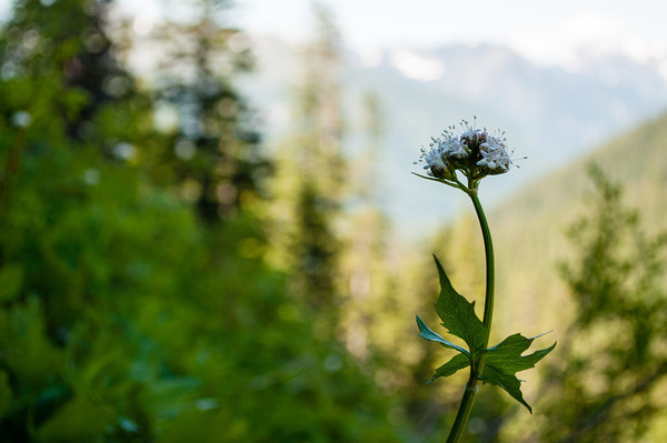
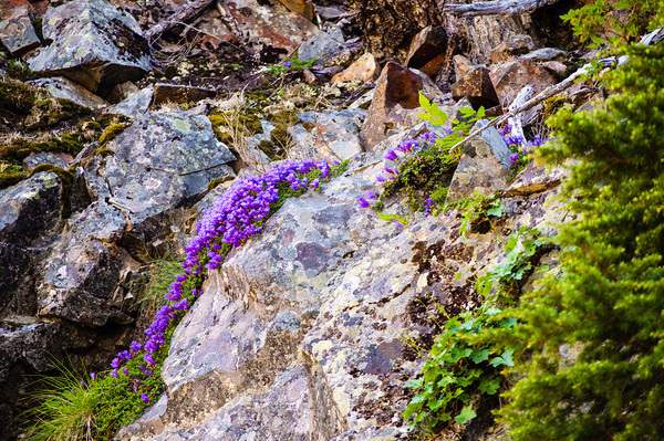
On our kill day, Sunday, a small scramble about 1,000 feet up the southeast slopes of Humpback Mountain brought us to a beautiful overhead view of the lake and clear views of jagged Abiel Peak and the rocky scree slopes leading up to Silver Peak (east of our campsite). Small patches of wildflowers added some beautiful softness and color to the hard edges and earth tones of the alpine landscape.
 |  |
Being so close to home let us relax and have a leisurely Monday morning. We headed out after a light breakfast, water refills, and breaking down camp. Someone forgot to tell the youngest member of our party that we really weren't in any rush to get down and he set us on a skippidy-doo-da pace. We cruised right past the falls on our hard-charging way up, so I stopped for a few minutes on the way down to soak them in. Sitting in the shade on the rocks under the bridge that spans the waterway, with mist on my face, was a nice reprieve from the sun.
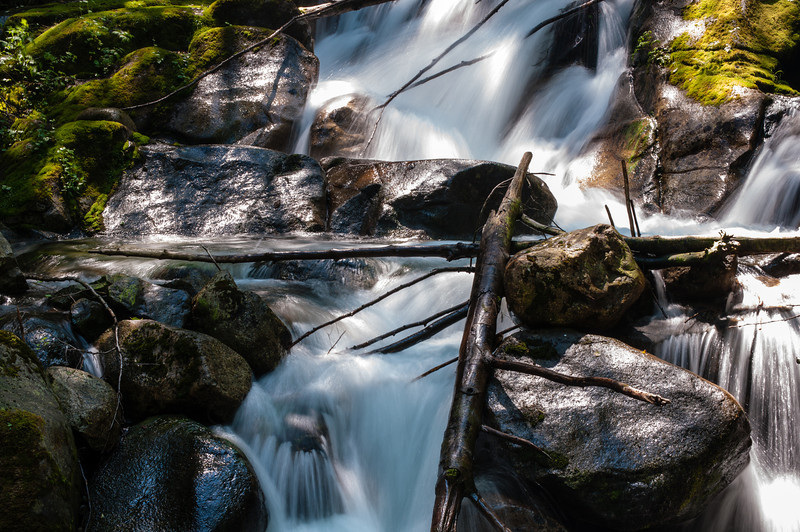
Photo Roll
Check out the Annette Lake gallery for more pictures.
Location and Trail Summary
Dense forest drapes the lower trail, keeping hikers cool on the hottest August afternoons. At trail's end, a deep lake waits to kill off the last of the summer heat--for those brave enough to dive into its icy waters. Between the thick second-growth forest stands and the high alpine lake, the trail rolls along Humpback Creek, offering tantalizing views now and again of pretty waterfalls along the tumbling creek. |